


We are in an exceptional free flight site.
It is on the Noguera region, (Lleida province), it include the valley limited for the Montsec mountain range and the Port d’Àger mountain range. The west limit is the Noguera Ribagorçana river and its Camarassa dam. The East limit is the Noguera Pallaresa river and its Camarassa dam. The maximum height of the Montsec mountain range is the Sant Alís peak, with 1678 m. The valley is oriented East-West and the slope of the Montsec is orientated South orientated, thing that make it a great site to soaring at the midday. There are many take offs and landing zones, and find alternative landing zones is not a problem.
All the take offs and landing zones are indicated in the forest roads, making easy to find it.
With a 30 years of history, in this site was organized many national and international championships, specially the Hang Gliding World Championship on 1995, giving an international projection of the site making it frequented for pilots of anywhere of the world.
TAKE OFF
We can access to the take offs by a forest road that begins at the west end of the village, near the cemetery. It is suitable for any type of tourism car. if we go for the principal road, after a few hard turns, we arrive at:
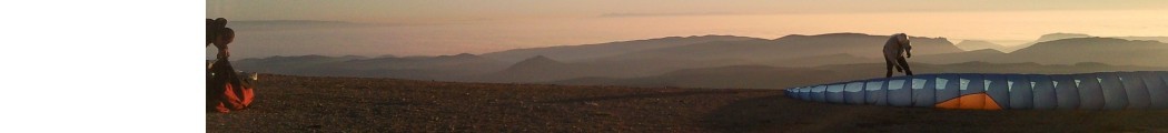
RAUDORAL, know as “sortida nova“
It allows to take off without go up to the top of the Montsec. If the weather is good, we can go up flying. Is a clean ramp that we can put some wings, but only take off one on one. It is faced South and is the first take off where the breeze arrives while the slope is getting heated. It is a lee side with East wind, and we do not recommend the use. Height to the Camping landing field: 500 m
GPS: 31T 312693 , 4656422
Going on the road, leaving the 300 landing field (see landing fields) we find a road on the right. If we drive to this road we arrive at:
GABRIELÓ, known as TABLONES
It is a take off with a spacious zone to put the hang gliders and wings. We take off only for one point, and we should look all the beams, because it is a technical take off. It is South faced, and not suitable with West winds. It is a good take off when the North wind impedes to take off from the top of Montsec. Height to Àger: 550m.
GPS: 31T 315102 , 4655761
Going on to the top of the Montsec, we arrive at the “Coll d’Ares”, with an amazing view of the Pyrenees (Pyrenees). On the left begins a road that goes down for the North face, we go straight, after 200 m. we arrive at:
COLL D’ARES, known as ROPER
It is a big and clear take off. It allows to prepare very much flyers and the usable take off is more than 50 m. of slope. It has a few beams to control the wind. It is South faced, but it allows to take off with West winds. If there is East wind, it is a little lee sided. It’s better to continue to the Sant Alís take off. The height to the Camping is 900 m.
GPS: 31T 313555 , 4657599
Going on for the road, over the Montsec we arrive at the peak of:
SANT ALÍS, known as LA PEDRA (the stone)
It is geodesic vertex. It offers an incredible view: The Montseny, Moncayo, Guara mountain range, Pyrenees from Navarra to Girona, Montserrat, Monte Caro, Prades and Montsant mountain range. We find a ramp that is not in use for now, because is dangerous. The take off is just on the left. It is South-East faced. Don’t use with West winds. The height to the camping is 1050 m. and to the T field, 1000m.
GPS: 31T 315237 , 4656809
There are more take off but there aren’t indicated and prepared. Use it only if you go with a local flyer.
LANDING
There are 4 official landing zones, but the valley is full of fields where we can landing without problem.
CÀMPING
It is near the Camping de la Vall d’Àger. We can go there for the road at the middle of the village. There is a panel. It is a rectangular field of 200 x 50 m., West – East oriented. It has beams. Careful with the turbulence of the trees with North wind.
GPS: 31T 315079 , 4652814
CAMP DE LA T
It has a 10 ha. of surface, allowing to landing many flyers at the same time. It is used for school slope and ULM landing field. Thanks to its shape (T) it is possible to landing wherever the wind comes. The principal arm has a incline of 10% and has 420 x 75 m. on the principal arm and 300 x 75 m. on the secondary arms. We have to look the field before landing because is possible was doing winch towing flights. In this case, avoid to landing between the winch and the students, avoiding the traction cable.
The ULM must landing in the principal arm from South to North.
GPS: 31T 313760 , 4655062
ALTERNATIVE LANDING FIELD (n by 300’s field)
Is a landing field situated in front of the take off “Coll d’Ares”. They are one height more or less than 300 m. from the take off . It is used when the height aren’t sufficient for pass to the valley.
GPS: 31T 313452 , 4656826
PLA D’AGULLÓ
Is a good landing field for hangliding because is a largest field and they aren’t trees in the near fields. Next to the road from Ager to Agullo.
It is a rectangular field of 300 x 300 m., and it is possible to land East-West and North-South.
WARNING: Only landing from July to October.
GPS: 31T 311841, 4653618
CAMP DE “PLA DE MATES” – MASIEROL
Next to the road that goes to Camp de la T and Coll d’Ager, on your right hand. Be careful with East wind. You do the approximation over an electrical tension cable.
GPS: 31T 313660, 465400
LA MASIA
Next to camp de la T.
COORDENADES: 31T 313506, 4654931
Get Albatros Escola de Vol bigger